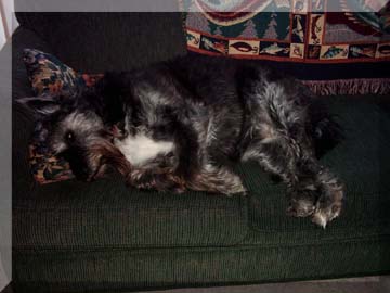
Well, August was generally a mellow month. There's not as much organized activity in Yellowknife in August as in July, and I had no major trips, which was a relief after the steady stream I'd had from April to July. This picture of Scully sums up August fairly nicely.

I even had time to do a jigsaw puzzle or two - imagine that! It helped that the boys were away for the summer so the house was a more quiet and unchanging than normal.
Although I was home for most of the month, I did squeeze in one adventure at the end. After shipping my car from Halifax to Edmonton in late July, I finally had a long weekend (the labour day weekend) to go pick it up and drive it home. I could have had it shipped all the way, but the cost from Edmonton to Yellowknife was the same again as the cost from Halifax to Edmonton. Crazy! Of course, there's no rail line running to Yellowknife, which likely accounted for the greater expense.
I flew down Friday morning and shipped Jasmine separately. I'd gotten a good deal on airfare with a small northern company, but found out after the fact that they wouldn't guarantee space for my dog. So I flew with the small airline into Edmonton's city centre airport and shipped Jasmine ahead of me via Canadian North cargo to the international airport south of town, where Canadian North lands. As it turns out, the small planes I took from Yellowknife to Fort Smith and Fort Smith to Edmonton weren't full, so there would have been room for her. How frustrating!
Anyway, as soon as I landed, I got a cab to the railyard, which was challenging in itself. It wasn't well marked at all and we had to ask for directions several times even when we were in the right area. At least I had a nice cab driver who turned his meter off for the last part of our search (I tipped him well to make up for it - at least I hope it was enough). Once I got my car back, I got directions for the best way to the international airport and boogied down to get my dog. Poor Jasmine! She was been well cared for, at least - I entered the cargo hangar to the sound of her tail hitting the side of the crate and some women talking to her. She was quite happy to see me, and I took some time to walk her, feed her, and so on before we hit the road back north.
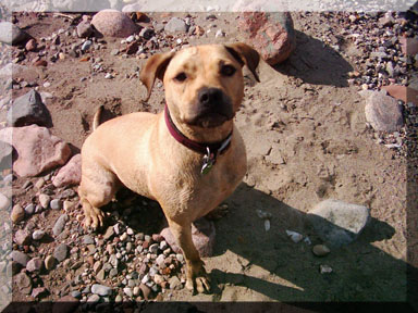
I also tried to make periodic stops along the way, partly so I could take pictures and smell the figurative roses, but also so Jasmine could have some fun. Here's Jas at one of our stops, where I'd been throwing sticks in a small river for her. You can see the wet texture of the fur on her shoulders - and also the hollow she's making with her wagging tail. She had a hard time sitting still for this! :-)
Once we left Edmonton, we drove west for a while, then northwest, eventually getting onto the lower part of the Alaska Highway. This isn't the most direct route between Edmonton and Yellowknife, but I'd heard the Liard Valley is beautiful and I thought I'd take this opportunity to see it by driving the long way home. As it turns out, it wasn't the best judgement call I ever made, but I'll come back to that in a minute.
The Alaska Highway was pretty neat. I'd like to go further on it sometime, but I'm not sure when that will be. Just northwest of Fort Nelson BC, we turned north onto the Liard Highway.
I giggled when I saw the road. It was great! No lines, not very wide, very quiet, yet a good road surface. What more could a person ask for in a road?? (Well, lots of hills and curves, but this still looked pretty good.)
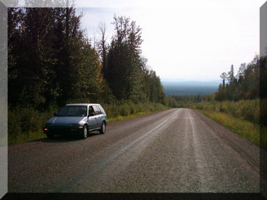
And so it was good for the next 50 km or so. I even got to see a black bear on the side of the road - the second of my trip, as I'd seen one along the Alaska Highway as well. Then things started to go downhill. First I hit some construction, but that was okay, it's gotta be done, right? I figured I'd just suffer through the construction while it lasted, then enjoy the road on the other side.
Unfortunately, the road never got better again. It's hard to say exactly where the construction ended because most of the major potholes and bumps were flagged on the BC side. Certainly they weren't all in the active repair section, but at least they were noted. Well, most of them - the flip side of that is that the unmarked ones were much more likely to catch you by surprise because you got used to the flagging. Ouch!
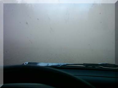
One thing about the active construction section is that it was being kept wet to keep the dust down. Once I got past the wet and mucky section, it was the dustiest road I'd ever seen - or not seen, as the case may be. I could see big trucks coming from miles away by the dust cloud and I had to pull over when they passed so I wouldn't run into anything or drive off the road. I tried to take a picture of the approaching cloud, but my timing was off so all you could see was grey out my car windows. See? The top of my dashboard, my wiper, and a bit of lightness where the road cuts between the trees - and the fact you can see that much means it probably was settling a bit already!
So that's how it went for a while. A long while, it seemed. And I thought Hey, maybe it will get better when I get to the Northwest Territories border. I mean, there's only a few roads into the Northwest Territories, right? Ha ha ha, such naivete!
Here's what I saw at the border:
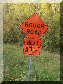
They were lying. It was MUCH more than 37 km. In fact, the road was unpaved from the BC construction zone, all the way through the Liard Valley, all through the MacKenzie Valley (except between the junction of the Liard and MacKenzie highways and Fort Simpson - try to figure that one out). I didn't drive on paved roads again until I hit the main highway just south of Fort Providence. That means I was driving on dirt roads for half of Saturday and most of Sunday. That's a lot of dirt roads, especially in a 13-year-old car. Sorry, little car! I just didn't do my homework for this trip. And honestly, there were some beautiful places along the way, but I'm not sure I'd recommend the trip overall unless you have a good, solid truck.
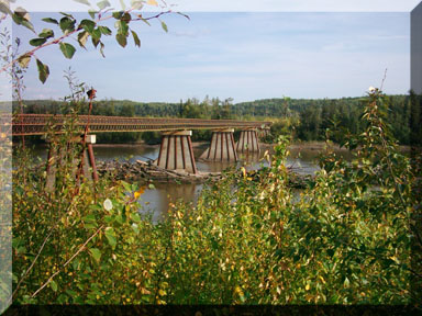
Here's one of the more attractive parts of the trip (which was still on the BC side of the Liard Highway). This bridge was a single lane wide, mostly wood, with two parallel wooden wheel tracks running lengthwise on top of the crosspieces of the bridge. It was neat and I truly regret that my Nikon SLR stopped working at about this point in the trip. (The shutter mechanism occasionally jams and I couldn't get it to free up. My friend Eli and one of his co-workers at the camera shop got it working for me back in Yellowknife and showed me what to do for the future, but that still meant that I spent hours on a dirt road and couldn't even take pictures with my best camera! I'm awfully glad I had my digital with me as well.)
The first community inside the Territories is Fort Liard. I hit there mid-evening, when my light was starting to fail, so I only stopped long enough for gas and a fudgesicle. I rather wish now that I'd taken time to drive to the river, but that day I just wanted to get as much ground behind me as I could before I stopped for the night.
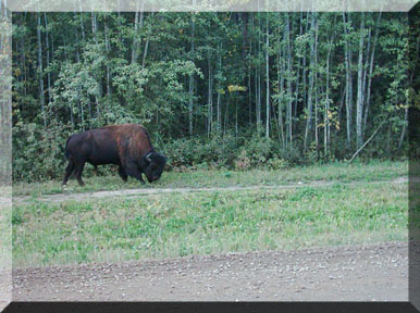
I did at least drive through Fort Liard and saw this lone bison trundling beside the road to and from town.
I had planned to stay in Nahanni Butte, which is the closest community to the beautiful Nahanni National Park. Once again, I hadn't asked enough questions before making this decision - it is only accessible by a winter road. The muddy track that left the Liard Highway was blocked by a large vehicle, I don't even remember what but it was some sort of construction vehicle.
So on I went, driving, driving, driving, with the rocks pinging off the underside of my car and the whole thing making noises that I really didn't want to hear. I could see on my map that there was a territorial park not far past the turnoff to Nahanni Butte, so I decided I'd aim for spending the night there. I'd packed a tent (which I used on Friday night in Dawson Creek) or figured I could sleep in the car if it seemed the safer option.
Soon, I came to a small resting spot marked by territorial signs. Was this it? Really?? It consisted of a picnic table, a water pump, a small grassy area, and unfinished pit toilets that weren't yet ready for use. And a river gurgling in the background. I didn't know all this right away, mind you, because it was too dark to see much at that point. What I *did* see was a man standing by his motorcycle with a flashlight, trying to read his own map. We compared maps and ideas; both of us wanted to camp in the territorial park, and neither of us was sure this was it. However, he was worried about having an accident on his bike in one of the soft-filled potholes and I was worried about my car falling apart with nobody around (I'd been seeing a vehicle once or twice an hour for the last while and expected that to taper off now that it was later). Tommy and I both decided to pitch our tents at this little stopping place and I felt safer with him - a complete stranger - than facing the prospect of breaking down or camping alone somewhere else.
It actually was quite nice to have the company. It turned out Tommy had come over from Denmark with his bike and was taking a year to travel around North America. He started in Vancouver, went up the coast to Alaska, then partway back down the Alaska Highway before going north on the Dempster Highway to Inuvik, then back down to the Alaska Highway before following my route up the Liard Valley. If I thought it was a crappy road in a car, I'm sure it was much worse on a motorcycle, even a nice BMW cruiser.
Tommy was also better prepared for camping than I was, since it was to be his primary accommodation for most of his trip. He had a stove and shared some hot food with me, which was wonderful, and we chatted by the picnic table for a while before going to bed.
The next morning it was raining. Jasmine showed no interest in leaving our tent, but I left the flap open for her while I got changed and packed things in the car so she wouldn't feel trapped in there alone. She didn't. I eventually had to kick her out so I could pack up the tent. Tommy was still in his tent when I left, presumably asleep, but I'd given him my contact information in Yellowknife the previous evening so he could call me while he was in town if he wanted. We did end up going for dinner one night and he gave me the address for his trip website, which his brother in France has been building for him. I left the address on my work computer and I don't think I'd find it with a search because it was in Danish, but I'll add it here later if I think of it.
So here's our campsite in the morning wet. I took this after I packed up, so all that's left is Tommy's bike and tent.
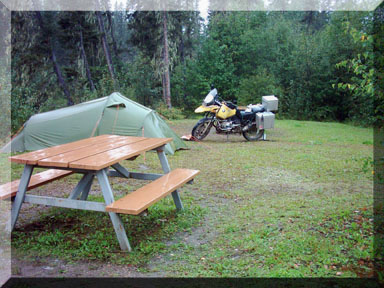
Oh, one added bonus of camping with Tommy - he had an alarm on his bike that he could trigger remotely. He warned me the night before that he'd set it in case there was any sign (or sound) of bears during the night. Hey, that works for me!
So here's the real kicker: about 3 km up the road from where we camped, I passed a major territorial park. Argh! I'd like to blame poor signage, but I'm honestly not sure that was the problem. Maybe I just was too tired to pay close attention to the signs that were there... or maybe I misinterpreted them. Oh well, no harm done and I had an interesting experience anyway.
About halfway back along the MacKenzie Highway, there was another territorial park. There's a number of waterfalls in the region around the southwestern arm of Great Slave Lake, and this was one of the ones along my route. There was a parking area just off the road from which trails went upriver and downriver. This is the upriver section:
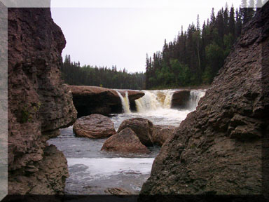
And this is downriver, on the other side of the MacKenzie Highway (you can see the bridge across the river - I'm downriver from the parking area, but looking upriver).
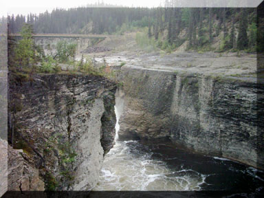
I don't think you can see it in this picture, but there was a cross with flowers along the left cliff. I took that as a warning and watched my footing, keeping well back from the edge, and I tied Jasmine to a tree every time I wanted to get a bit closer for a picture. The last thing I wanted was either of us slipping or stumbling because we were uncumbered by each other via a leash!
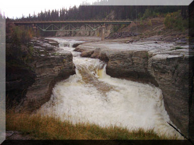
The river cuts a pretty sharp gorge in this section. I went a bit farther downriver and once again looked back for my photo. This doesn't do it justice, but it may be enough to convey a bit of the beauty of the place.
In addition to being beautiful, this park also had some interesting quirks. Check this out:
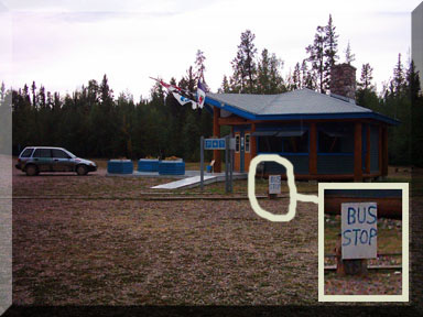
Okay, I'm literally miles from the nearest community, it feels like the middle of nowhere, I see a handful of vehicles every hour, and then hand-lettered bus stop sign at the park! Sometimes you just have to smile at life.
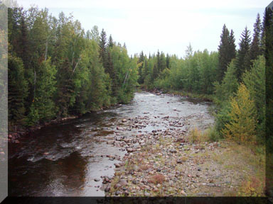
This next picture is nowhere that is easily identifiable - meaning there were no signs, communities, or other things to tell me where I was. But it was pretty, and sometimes that's more than enough. (My Nikon would have done a better job of it, darn it!)
Eventually I did, in fact, get back to civilization. In this case, I mean paved roads. I drove the short distance north to the Fort Providence ferry crossing on the MacKenzie River (which, by the way, you can rarely if ever see while driving on the MacKenzie Highway. That came as a surprise to me, which is yet another example of me not looking at a map closely enough while planning my trip). When I eased to a stop in the ferry line-up, I heard a nasty clatter. I got out to take a look and was just about picked up and carried off by the blackflies. It's not that they were that big, but there were so many! Fortunately, some of the people standing outside (with bug hats and jackets) were able to ease my mind about my car - when they saw me peering at it, they told me the sound had been rocks falling out. Nice! If you look closely at the next picture, you can see ridges of dirt and gravel behind my rear tires. Yep, it all came from my poor beast!
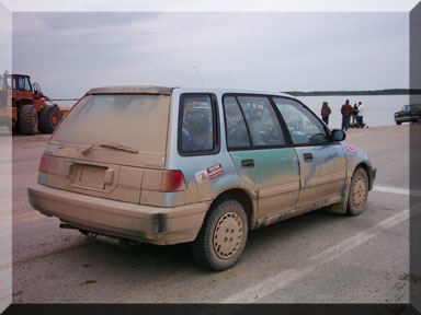
Having established that my car wasn't actually falling apart, I thanked the bystanders and scrambled back inside and spent the rest of the wait for the ferry squishing blackflies inside my car. And yes, I had closed my door when I got out.
Nothing very eventful happened for the next few hours. I got gas in Fort Providence. I cleaned my windshield so I could see (it was really gross). I can't remember whether I saw any bison or not... I think there were a few, but no great quantities. That area is a protected area for the bison, so it would be more unusual to not see any than to see any.
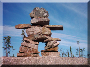
Just past Rae, I saw this inuksuk on a roadside cliff. It is one of the most aesthetically appealing inuksuit I've seen - inuksuit being the plural of inuksuk. I haven't learned much Inuktitut, but I've picked up a little bit here and there. Well, I actually didn't learn that until September when I went to Nunavut, but that's the beauty of catching up on some things months later. :-)
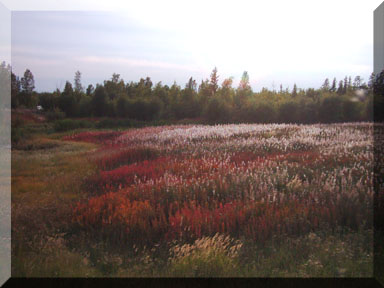
Another lovely sight along the road between Rae and Yellowknife was fields of coloured grasses and flowers that were shining in the sunlight. If there had been a good place to park, I would have gone for a stroll and maybe flopped down on my back in the middle of it all, but my car might have been run over on the narrow shoulder if I'd left it there too long. Ah well.
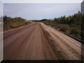
Here's one of the better stretches of road between Rae and Yellowknife. It was, by far, the worst section of road on my entire trip. I thought I was going to get stuck a couple of times. In defense of the territorial government, they're currently building a new highway at $1,000,000 per km. I guess it's no wonder it takes a while to complete, but in the meantime, the road is better in the winter when it's frozen and it's not great even then.
So that's about it. I did get back to the paved roads of Yellowknife and blissful smoothness and silence (relatively speaking). It was good to be home, it was an interesting trip, and now I have my car in Yellowknife.
Jan